Comprehensive Land Surveying Services in Asaba & Delta State
GeoLead Associates, led by Surv. A. A. Okeke, provides a full range of professional surveying services for residential, commercial, and government clients across Delta State.

Boundary Surveys
Our boundary survey service is the most requested by property owners in Asaba and across Delta State. Surv. A. A. Okeke and the GeoLead team accurately determine and mark your property lines using modern GPS and total station equipment.
- Property boundary determination and beacon placement
- Registered survey plan preparation
- Charting at the Surveyor General's office
- Red copy survey plan processing
- Land dispute boundary verification

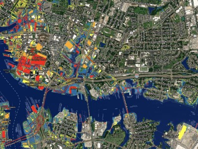
Topographic Surveys
Our topographic surveys capture detailed elevation data, natural features, and man-made structures on your land. Essential for architects, engineers, and developers planning construction projects in Asaba and Delta State.
- Contour mapping and elevation profiles
- Site plans for building plan approval
- Drainage and flood analysis
- Terrain analysis for estate development
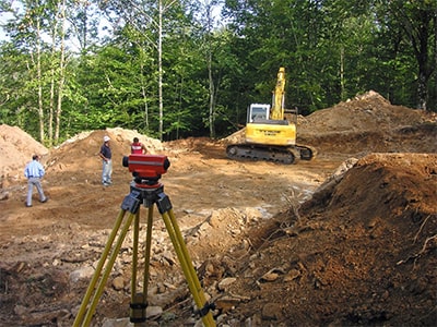
Construction Surveys
Precision construction staking and as-built surveys to ensure your building projects in Asaba are accurately positioned, correctly aligned, and meet regulatory requirements.
- Building setback and setout surveys
- Foundation and structural alignment checks
- As-built surveys for completed structures
- Route surveys for road construction
Land Subdivision
Expert land subdivision services by Surv. A. A. Okeke, dividing large parcels into individual plots with proper documentation and compliance with Delta State land regulations.
- Estate layout planning and design
- Individual plot demarcation with beacons
- Subdivision survey plans for each plot
- Compliance with town planning regulations
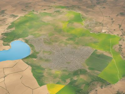
GIS Mapping
Cutting-edge Geographic Information System (GIS) mapping services by GeoLead, providing comprehensive spatial data analysis for projects in Asaba and across Delta State.
- Digital terrain models (DTM)
- Land use and land cover mapping
- Spatial data analysis and visualization
- Geodatabase creation and management

Title Surveys & C of O Processing
Comprehensive title surveys and Certificate of Occupancy (C of O) processing by Surv. A. A. Okeke. We handle the entire documentation chain for property ownership in Delta State.
- Title survey for property transactions
- C of O application and processing
- Governor's consent processing
- Deed of assignment preparation
- Survey plan verification and authentication